Read Time 3 mins
21/12/2022
We explain in this article how we saved our clients thousands of pounds and saved them weeks of time by using drones, safely, cheaply and efficiently, to carry out an aerial roof inspection for them.
The Problem
Traditional methods of roof surveying require either inaccurate ground based views, scaffold, cherry pickers, ladders and/or walking on the roof. All which are time consuming, expensive and carry the risks of working at height. Parts of the structure maybe inaccessible making traditional methods potentially inaccurate. When the rough area of the damage to the roof is unknown unnecessary time and expense is expended trying to locate the problem.
In summary the traditional methods of inspecting roofs are prohibitively expensive, inefficient, potentially dangerous and inaccurate.
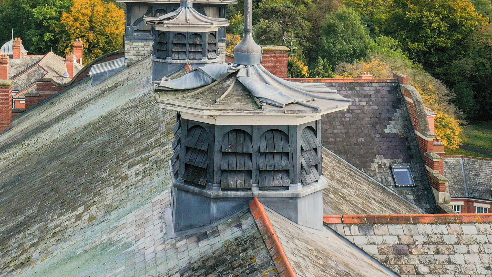
And so it transpired with our customer. They have a 20 metre high complex of flats, a beautiful conversion from an old Victorian hospital building with towering ceilings and sash windows. They suspected that there was trouble with the roof as they were suffering from an ingress of pigeons. They had no idea, even roughly, where the damage was.
The building is too high for cherry pickers and the whole building would have needed to be scaffolded in order for the roof inspection to be thorough. The scaffolding process would have been a huge inconvenience to the residents and extremely expensive.
The Solution
We were tasked to carry out a drone inspection of the roof and facades of the building. With drones we were able to carry out the inspection within days of the request being made and provide the data to the client within 24 hours of flying the inspection.
The drone was programmed to fly to take overlapping high resolution photos of every inch of the roof and facades of the building. These images were then provided to the customer using an online portal where the damaged can be accurately located and assessed.
We created an orthomosaic map of the roof. This is a method of mapping where the drone takes many overlapping images which, using specialist software, are then stitched together to create a large incredibly accurate image of the roof. From the orthomosaic map measurements can be taken with centimetre accuracy. The orthomosaic map not only allows for highly accurate assessments of the damage but is an enormously useful tool in estimating costs of repairs.
The data we provided was not only quickly turned around but highly accurate. So now resources such as scaffolding can be targeted to the specific area where the repairs are required providing the associated savings in cost and time.
The cost of the drone roof inspection was a fraction of what traditional inspection methods would have cost, negligible in the scheme of things.
Once the remedial work has been completed we will be tasked to take further drone imaging to allow the client to assess the quality of the repairs carried out. We will also be carrying out regular aerial roof inspections of this property to allow the client to preempt further expensive repairs.
Summary
Traditional methods of roof inspections are time consuming, inefficient, inaccurate, eye wateringly expensive and potentially dangerous.
With a drone we can carry out aerial roof inspections quickly, cheaply and with minimal inconvenience. The data can be provided within 24 hours.