Read Time 10 mins
24/05/2023

Introduction
In the rapidly evolving world of construction and building industry, effective communication and seamless data sharing are integral components that can significantly influence a project's timeline, efficiency and cost-effectiveness. The age-old challenge, however, lies in efficiently sharing highly detailed and timely updates about a construction site, especially when dealing with multiple remote agencies. This becomes even more daunting when you consider the dynamic nature of construction sites, where circumstances can change dramatically from one day to the next.
Imagine if there was a solution that could provide accurate, real-time updates about your construction site and could be easily shared with all stakeholders involved, regardless of their location? What if this solution could revolutionise the way you handle data, mitigate communication issues and improve overall project efficiency?
Enter Drone Mapping, a revolutionary technology that is set to redefine how information is managed and shared in the building industry. With Drone Mapping, you can capture high-resolution, real-time data and imagery of your site, making it easier to share updates, monitor progress and make informed decisions swiftly.
In this article, we delve deeper into the challenges plaguing the building industry, explore the transformative potential of Drone Mapping and guide you on how our innovative drone services can give your construction project the edge it needs.
The Current Challenge in the Building Industry
The building industry, more than ever, relies heavily on the timely availability of accurate information to ensure that projects are completed within the designated timeframe and budget. However, one of the most pressing issues facing the industry today is the difficulty in sharing highly detailed and up-to-date data about construction sites, particularly when multiple remote agencies are involved.
Traditional methods of data gathering and sharing, such as manual surveys, paper plans and periodic site visits, are no longer sufficient or efficient. These methods are time-consuming, often inaccurate and involve high levels of human effort. They also raise significant barriers to the real-time sharing of data, causing delays and miscommunication.
When dealing with remote agencies, these challenges are compounded further. Information must be shared across different platforms, which increases the risk of data being misinterpreted or lost. Moreover, keeping these multiple stakeholders updated about site changes in a timely manner can often be a logistical nightmare.
The impacts these challenges have on project timelines, cost and overall efficiency are significant. Delays in data transmission can slow down decision-making processes and extend project timelines. Inaccuracies can lead to costly mistakes and rework. Inefficiencies in data sharing can also lead to communication gaps, potentially causing disputes among stakeholders and subsequently, further delays.
In an industry where time and budget constraints are often tight, these data sharing issues can hinder the smooth progression of projects, affect the quality of the final outcome and even impact a company's reputation. As such, finding an efficient way to share highly detailed and up-to-date information is not just a matter of convenience, but an imperative for the success and growth of businesses in the building industry.
The Power of Drone Technology in the Building Industry
Drone technology, also known as unmanned aerial vehicles (UAVs), has been at the forefront of technological innovation over the past decade. Originally developed for military purposes, drones have since found their way into numerous civilian applications. From agriculture and wildlife conservation to photography, search and rescue missions and even delivery services, the flexibility and capabilities of drones have made them indispensable tools in various fields.
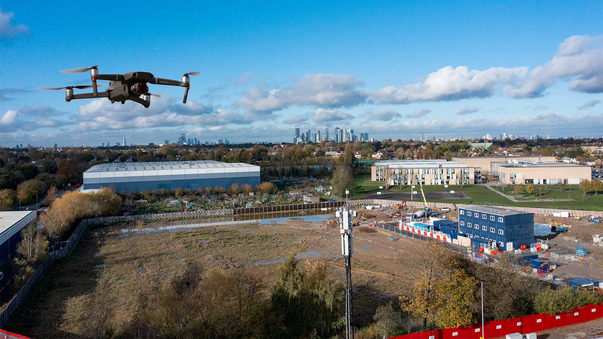
In the building industry, drone technology is rapidly changing the landscape. These flying devices provide a bird's-eye view of construction sites, allowing for comprehensive visual inspections and assessments that would otherwise be difficult, if not impossible, to perform from the ground. They can traverse any terrain, regardless of how rough or inaccessible, capturing detailed imagery and data that can greatly facilitate construction planning and management.
What is Drone Mapping and How Can It Help?
Drone Mapping is a powerful application of drone technology where drones, equipped with high-resolution cameras or other sensing devices, are used to create detailed representations of areas, typically in the form of maps or 3D models. It involves capturing a series of aerial images, which are then processed using specialised software to create these representations.
But how does Drone Mapping help the building industry? Firstly, it provides real-time, high-resolution data. The drones can be flown over construction sites as often as needed, capturing images and other data in real-time. This ensures that all stakeholders have the most up-to-date information about the project's progress and any site changes.
Secondly, the data captured by Drone Mapping can be easily shared. The digital nature of this data means it can be quickly and efficiently disseminated among all agencies involved, regardless of their geographical location. This promotes better communication and collaboration, as everyone can see the same data and base their decisions on it.
Lastly, Drone Mapping keeps all agencies involved in the loop. By providing regular, timely updates, every stakeholder is continually informed of the project's status, thereby reducing the chances of miscommunication or misunderstanding. This promotes seamless collaboration, helps in avoiding delays and enhances overall project efficiency. In essence, Drone Mapping is a game-changer for data sharing and collaboration in the building industry.
Benefits of Using Drone Mapping in Your Building Projects
Drone Mapping offers a myriad of benefits that significantly impact the efficiency and effectiveness of building projects. Firstly, it helps in improving project timelines. With real-time, high-resolution data readily available, decision-making processes are sped up, reducing time wastage and ensuring that the project stays on schedule.
Cost-effectiveness is another crucial benefit. By accurately capturing the site conditions and monitoring the progress, Drone Mapping minimises the chances of expensive mistakes and reworks, thereby saving money. It also reduces the need for frequent site visits, cutting down travel costs and time.
Drone Mapping enhances safety by limiting the need for manual inspections, which often involve potential risks. By using drones, hazards can be identified from a safe distance and risky areas can be avoided.
Furthermore, the accuracy of the data provided by Drone Mapping is unprecedented. It provides detailed insights, right down to the millimeter level, which is crucial for precision in the building industry.
Take, for example, the case of a large commercial building project. Utilising Drone Mapping, the project team could track progress in real-time, identify any deviations from the plan promptly and make quick decisions to rectify issues. The high-resolution imagery also helped them spot potential safety hazards which were promptly addressed, promoting a safer work environment. The result was a project that was completed on time, within budget and with a high degree of safety and accuracy.
How to Implement Drone Services in Your Next Project
Implementing Drone Services in your next project is straightforward. Begin by contacting our experienced team. We will guide you through the process, tailoring our services to your project's specific needs. Our offerings include detailed site analysis, progress tracking, volumetric analysis and more.
Our expertise, backed by cutting-edge drone technology and advanced data processing software, sets us apart in the industry. We are committed to delivering accurate, timely and actionable data to help you maximise efficiency and achieve your project goals.
We encourage you to take the leap into the future of the building industry. Contact us today for more information or to get started with our Drone Services. You’ll be joining the ranks of many successful businesses that have already realised the immense benefits of Drone Mapping.
Conclusion
In an industry fraught with challenges in sharing highly detailed and up-to-date information, Drone Mapping emerges as a revolutionary solution. It addresses these issues head-on, improving project timelines, reducing costs, enhancing safety and increasing accuracy.
The benefits of using Drone Services are far-reaching and transformative, poised to shape the future of the building industry. It's high time to embrace this change and leverage its power for your next project.
Don't let outdated methods hold your project back. Contact us today and experience the unparalleled advantages of our Drone Services. Let's revolutionise the way you manage your building projects, together.
