Read Time 5 mins
06/04/2024

Introduction
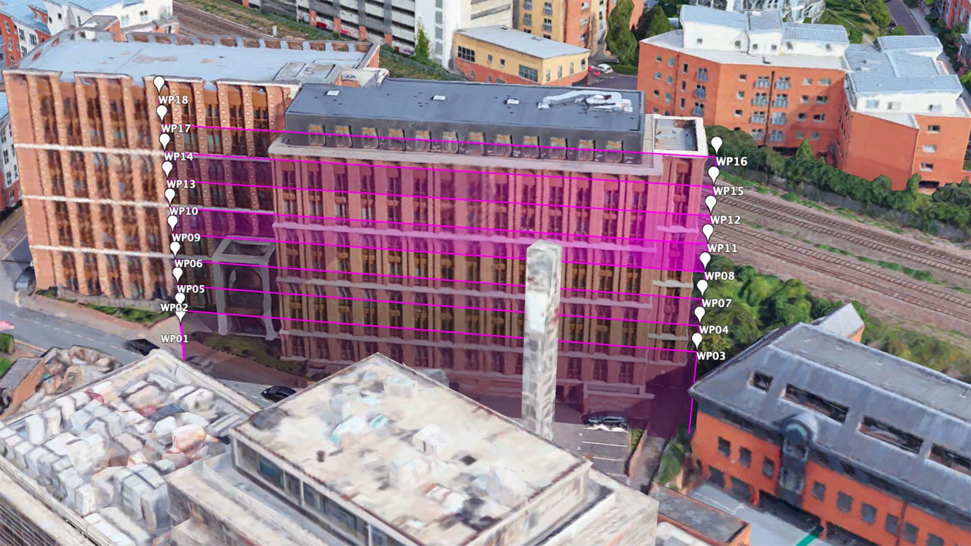
Configuring a façade mapping mission within the Litchi app can be somewhat cumbersome, as its Mission Hub is designed primarily for a top-down perspective, which does not align with the vertical plane of façade mapping. Additionally, the manual setup of waypoints across necessary altitudes for creating an accurate vertical grid is a time-intensive task. The Carrot Litchi Façade Mapping Waypoint Generator is designed to streamline this process and significantly reduce the setup time.
Workflow
Before starting, it's imperative to ascertain the image distance interval, required increase in row height, and the recommended flight speed for your drone. Utilize our GSD & Overlap Calculator to obtain this data for your specific drone model at Carrot's GSD & Overlap Calculator.
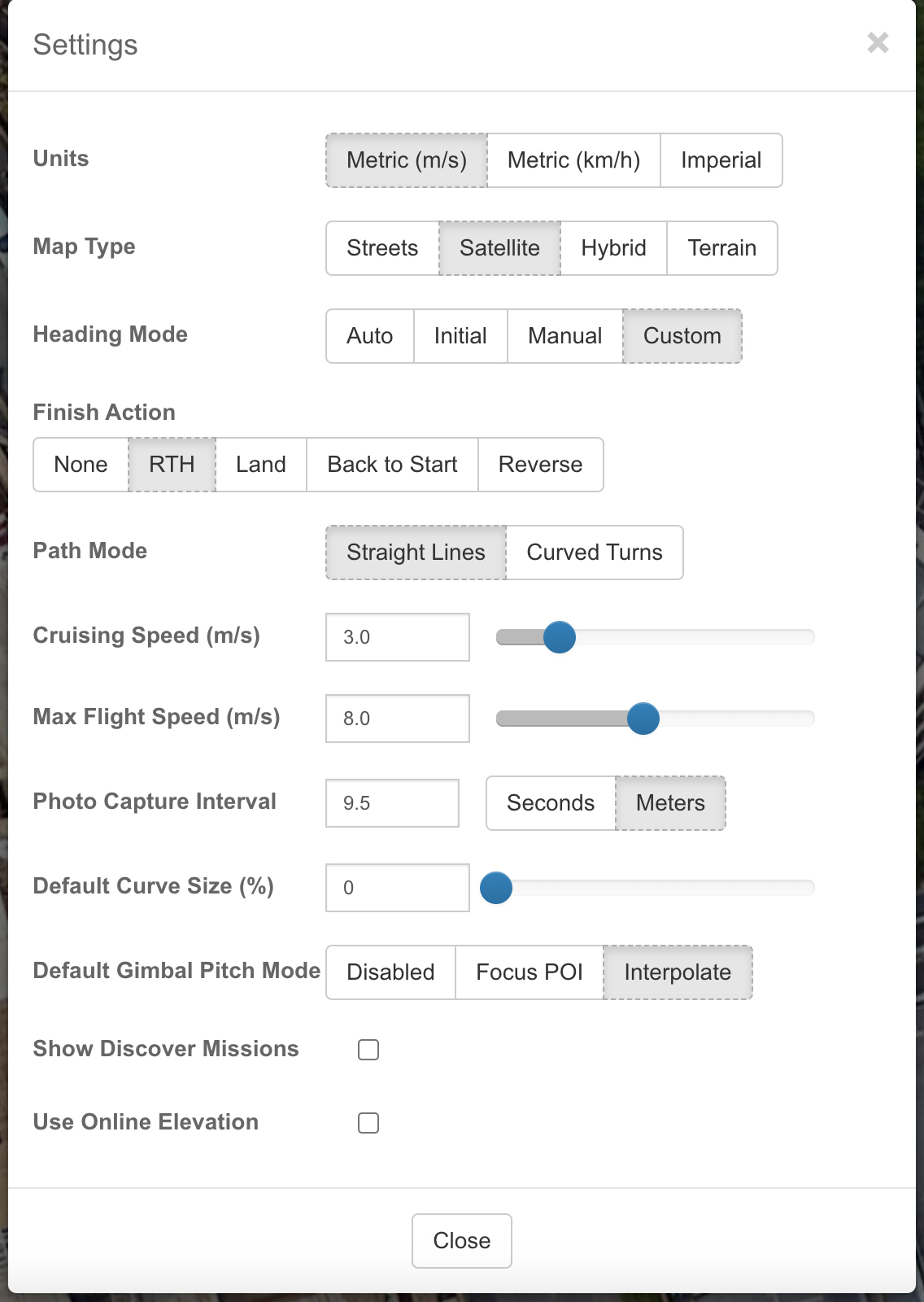
Proceed by launching the Litchi Mission Hub at Litchi Mission Hub and navigate to your intended site for mapping. Adjust the general settings in the Mission Hub as follows:
- Units: Metric (m/s)
- Map Type: Select as needed, though Satellite or Hybrid is suggested.
- Heading Mode: Custom
- Path Mode: Straight Lines
- Pitch Mode: Interpolate
Note that the CSV file import will overwrite other options.

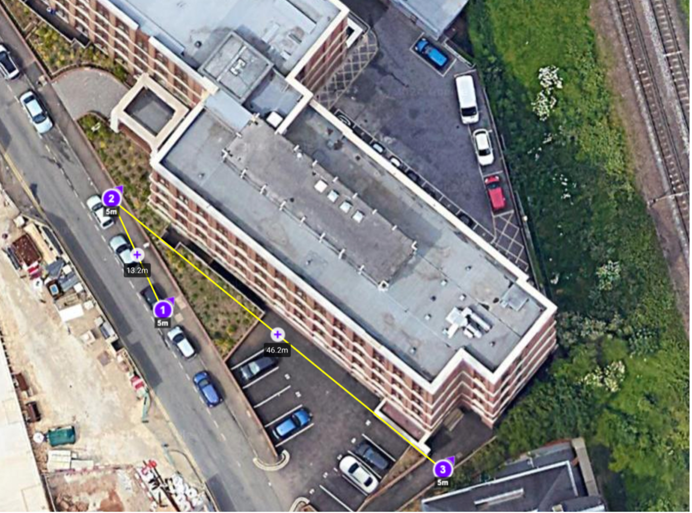
On the map, place your initial setup waypoint close to the façade mapping mission's start point. This is where the drone will ascend to the beginning altitude and orient appropriately. Then, set the second waypoint at one end of the mission's horizontal plane and the third waypoint at the opposite end.

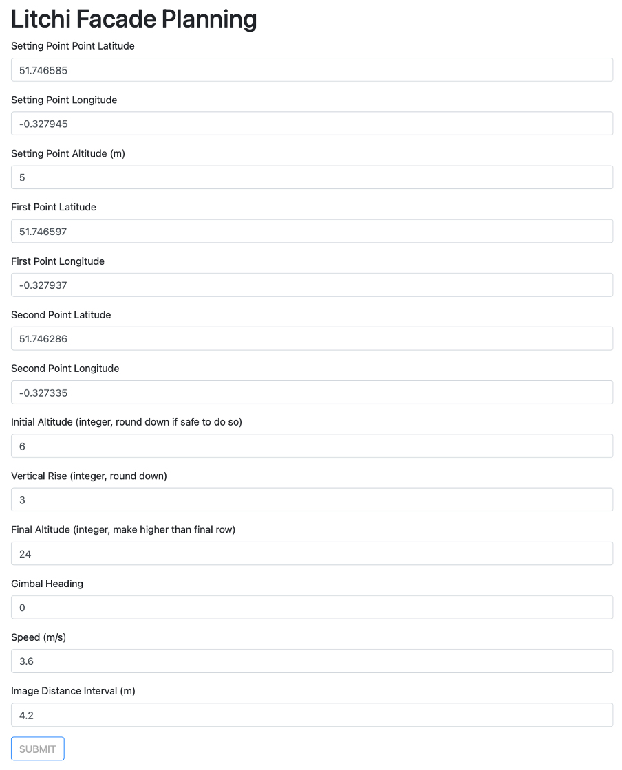
Now, access the Carrot Litchi Façade Waypoint Generator. Input all necessary details, using latitude and longitude values from the Litchi Mission Hub. Make sure all altitude values are integers and round down all figures—except for the final altitude—to ensure overlaps are maintained.

Inspect the generated data on the results page for accuracy. If it appears logical, proceed to export it to a CSV file. The CSV will download and can then be imported into the Litchi Mission Hub, which will now contain all waypoints correctly spaced, and with the image capture distance accurately set.