Read Time 5 mins
31/03/2023

Introduction
Drone mapping has become an increasingly popular method of collecting geospatial data for various applications, including land surveying, agriculture, and infrastructure monitoring. In this case study, our client, a woodland trust, wanted drone mapping done to assess the effect of building a new car park on the footfall on the chalk paths. Our team was tasked with collecting and analysing data to understand the changes in footfall over a period of three years.
Project Scope
The project required a Ground Sampling Distance (GSD) of 1.6cm, which is the resolution of the imagery. The drone was flown at a height of 70 meters, and the image acquisition required 75% front overlap and 70% side overlap to ensure complete coverage of the area. The drone used for the project was a DJI Mavic 2 Pro. The client did not require the use of Ground Control Points (GCPs) as only relative accuracy was necessary.
Data Collection
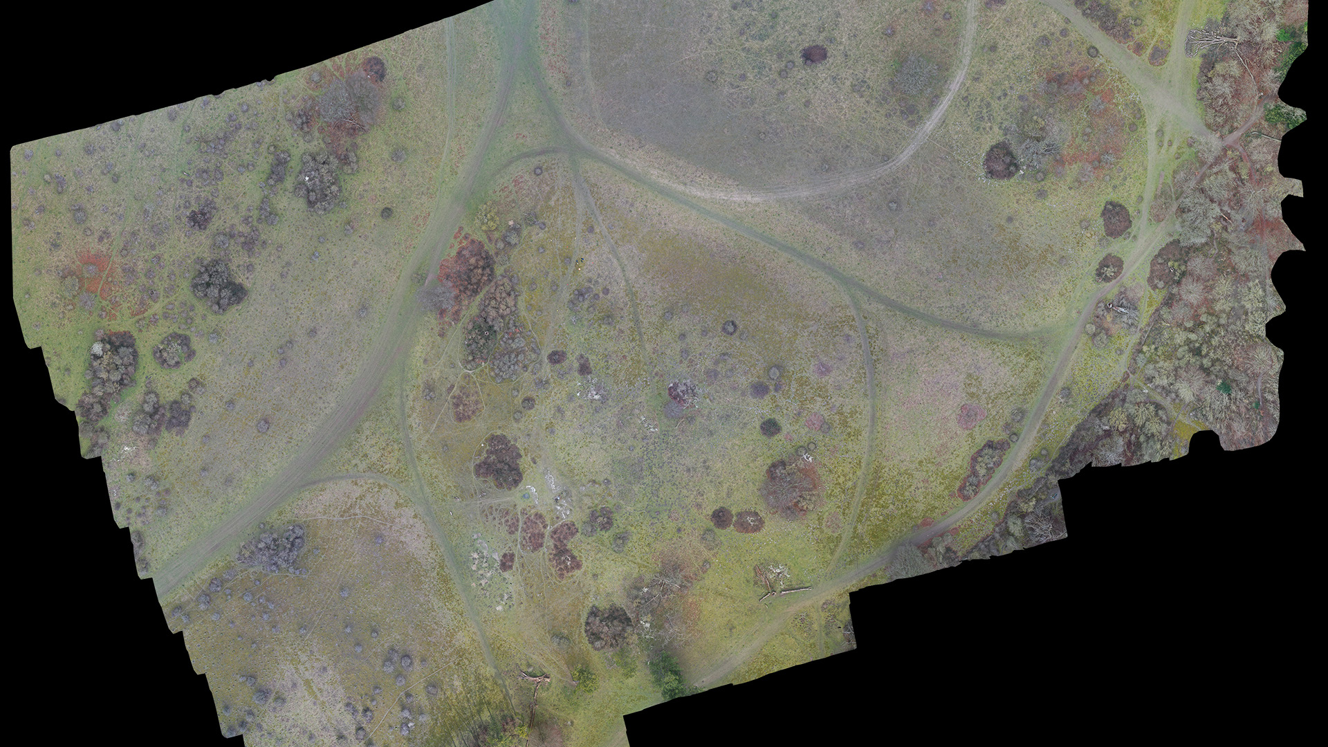
The first drone mapping project was carried out by our team using the specified parameters. The flight plan was designed to cover the entire woodland trust site, including the areas around the newly constructed car park. The drone was flown at a height of 70 meters, and the imagery was captured using the DJI Mavic 2 Pro. The imagery was then processed using photogrammetry software to create a 3D model of the site.
As the site had significantly varying terrain and we need to ensure that the drone maintains a consistent distance from the ground, which is important for accurate data collection. The terrain awareness function works by analysing the terrain data of the area where the drone is being flown. This data is typically obtained from a digital elevation model (DEM) or a topographic map. The software then uses this information to adjust the drone's altitude and flight path to ensure that it maintains a consistent distance from the ground.
Data Analysis
The processed data was used to create an accurate Orthomosaic map of the site, which was then analysed to determine the changes in footfall on the chalk paths. By comparing the data collected before and after the construction of the new car park, we were able to assess the impact on footfall. The data collected was also used to generate elevation models of the site, which helped to visualise the changes in the area.
Orthomosaic maps are used in a variety of applications, including land surveying, agriculture, infrastructure monitoring, and environmental monitoring. These maps provide a high-resolution, georeferenced image of an area, which can be used to identify features, measure distances, and create 3D models of the terrain. Orthomosaic maps are often used for site planning, land management, and resource planning. They are also used in disaster response and recovery efforts to assess damage and plan recovery operations. Overall, orthomosaic maps are a valuable tool in many industries and can provide valuable insights and information for a wide range of applications.
Future Comparisons
To track the changes in footfall over a period of three years, the client requested the site to be mapped every 6 months. This will allow us to monitor any changes in the footfall and assess the impact of the new car park on the site. By collecting data at regular intervals, we can provide accurate information on the changes in footfall and provide recommendations on how to improve the site.
Conclusion
Drone mapping has become a useful tool in collecting geospatial data, and in this case study, it was used to assess the impact of a new car park on a woodland trust site. The drone mapping project required a GSD of 1.6cm, a 70-meter flight height, 75% front overlap, and 70% side overlap, with no requirement for GCPs. By collecting data every 6 months over a period of three years, we can provide accurate information on the changes in footfall and assess the impact of the new car park on the site. This information can be used to improve the site and provide a better experience for visitors.