Read Time 7 mins
23/04/2023

Introduction
Drone mapping has revolutionized various industries by providing accurate, high-resolution geospatial data in a cost-effective and efficient manner. This technology has led to the creation of several output types that cater to specific needs in different fields. In this blog post, we will provide an overview of the most common drone mapping outputs, their uses across industries, and the software that can handle them. Whether you're a surveyor, urban planner, or a game developer, drone mapping has something to offer you.
Point Cloud (LAS)
Point Clouds are collections of 3D data points that represent the surface of a mapped area. They are typically stored in the LAS (LiDAR Data Exchange) format, a widely-accepted standard for such data. Point Clouds find applications in industries such as surveying, construction, forestry, and mining. They can be imported into software like AutoCAD, ArcGIS, CloudCompare, or Global Mapper for further analysis, modelling, and visualization.
Mesh (OBJ)
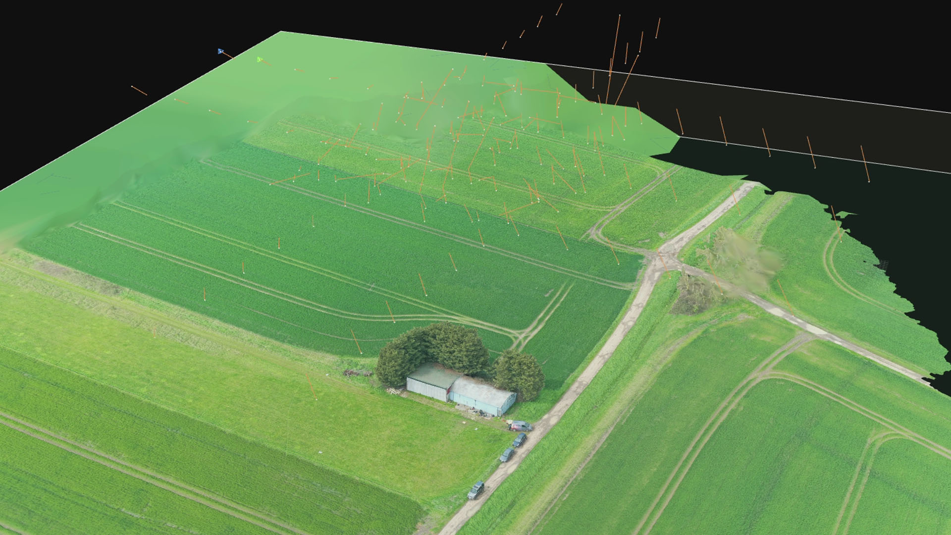
Meshes are 3D models composed of vertices, edges, and faces that represent the surface of the mapped area. The Wavefront OBJ format is a popular choice for storing such models. Meshes are widely used in 3D visualization, architecture, and game development, as they provide an accurate and detailed representation of real-world environments. Software like Blender, 3ds Max, and SketchUp can handle OBJ files for rendering and editing purposes.
Mesh (FBX)
FBX meshes are similar to OBJ meshes but are saved in the Autodesk Filmbox (FBX) format. FBX meshes are more versatile and can store additional information like textures, animations, and scene data. This makes them particularly useful in the entertainment industry for film, TV, and video game production. FBX files can be imported into software like Maya, Unity, and Unreal Engine for further manipulation and integration.
Orthomosaic
Orthomosaics are high-resolution, georeferenced images created by stitching together multiple aerial images taken by a drone. They offer an accurate and up-to-date representation of the mapped area and are widely used in agriculture, environmental monitoring, and urban planning. Orthomosaics can be imported into GIS software like ArcGIS, QGIS, and Global Mapper for analysis, visualization, and decision-making purposes.
Digital Surface Model (DSM)
A Digital Surface Model (DSM) is a 3D representation of the earth's surface, including both natural and man-made features. DSMs are valuable in flood modelling, line-of-sight analysis, and telecommunications planning, among other applications. They can be analysed and visualized in GIS software like ArcGIS and QGIS, providing valuable insights for various industries.
Digital Elevation Model (DEM)
Digital Elevation Models (DEMs) are similar to DSMs but represent only the bare earth elevation, with man-made structures and vegetation removed. DEMs are essential for hydrological modelling, terrain analysis, and geological studies. They can be processed and visualized in GIS software like ArcGIS, QGIS, and Global Mapper, offering a detailed understanding of the natural landscape.
Contour Lines
Contour lines are lines that connect points of equal elevation on a map, providing a visual representation of the terrain's slope and relief. They are useful in industries such as civil engineering, cartography, and urban planning. Contour lines can be generated from DEMs and used for tasks like designing roads, analysing drainage patterns, and estimating cut and fill volumes. They can be visualized and processed in GIS software like ArcGIS, QGIS, and Global Mapper.
NDVI Maps (Normalized Difference Vegetation Index)
NDVI Maps are a type of remote sensing output that allows users to assess vegetation health and density. They are widely used in agriculture, forestry, and environmental monitoring. NDVI Maps help identify areas with stressed or unhealthy vegetation, monitor crop health, and estimate yield. They can be generated using multispectral imagery captured by drones and can be visualized and analysed in GIS software like ArcGIS, QGIS, and specialized tools such as Pix4Dfields or Agisoft Metashape.
GCP (Ground Control Points)
Maps GCP Maps are drone mapping outputs that use ground control points (georeferenced markers) to improve the accuracy of the final map or model. GCPs are essential in industries that require high-precision measurements, such as land surveying, engineering, and construction. GCP Maps can be created using specialized drone mapping software like Pix4D, DroneDeploy, or Agisoft Metashape, which incorporate GCP coordinates to refine the georeferencing of the resulting outputs.
In conclusion
Drone mapping technology offers a wide range of outputs that cater to diverse applications across numerous industries. With a deeper understanding of Point Clouds, Meshes, Orthomosaics, DSMs, DEMs, Contour Lines, NDVI Maps, and GCP Maps, professionals can leverage the full potential of drone mapping to make informed decisions and optimize their workflows. As drone technology continues to evolve, it is essential to stay up-to-date with the latest developments and explore how these versatile outputs can revolutionize your specific field of work.